
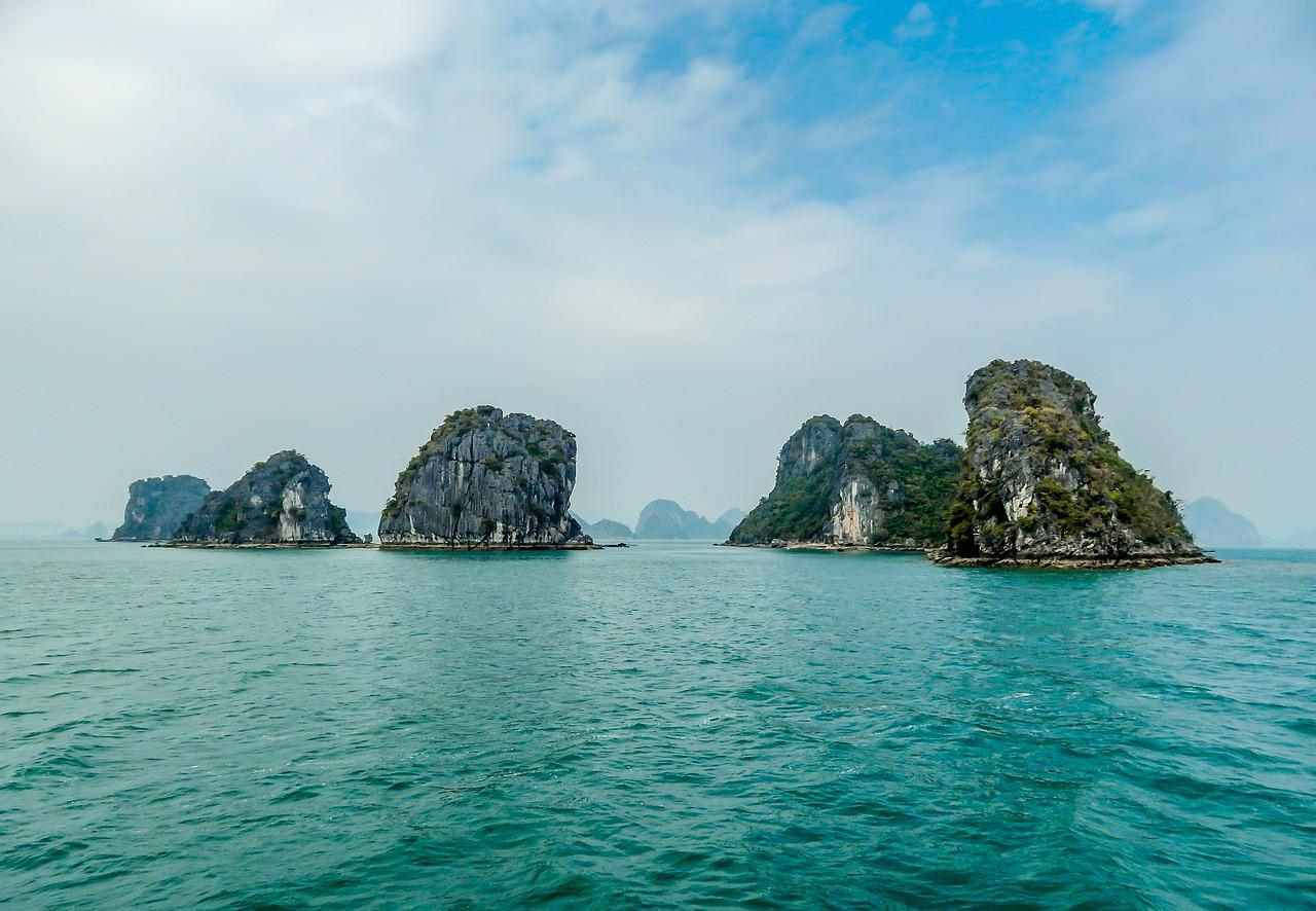
If you are one of those who like to travel, you may have noticed and heard that some popular holiday destinations, islands especially, may soon no longer exist.
Islands particularly are massively threatened by anthropogenic climate change. They are sinking, affected by intense storms, and threatened by sea-level rise, but they also suffer from dwindling freshwater resources and coastal erosion depending on the location.
Climate change is causing the ice in the polar regions to melt faster and the oceans to swell: sea levels rose by 15 centimeters worldwide in the 20th century, i.e., around 1.5 millimeters per year. In the meantime, however, the level is rising more than twice as fast.
Sea levels are rising about 3.6 millimeters per year, according to the latest special report from the Intergovernmental Panel on Climate Change (IPCC) in September 2019.
This article has mentioned some islands that are suffering most from the devastation of climate change and may soon disappear from the face of the earth.
Table of Contents
1. Kiribati

| Total Area | 811 sq km |
| Population | 119,940 |
| Region | Pacific |
| Famous for | Coral atoll and Reef Islands |
| Height above Sea Level | 1.8 m |
Kiribati, the small island nation in the middle of the Pacific, has gained notoriety as the country that may be the first to fall victim to climate change.
For many years, scientists have predicted that much of Kiribati could become uninhabitable in the coming decades due to environmental concerns related to climate change.
And for almost all these years, very few people have paid attention to these warnings.
Most of Kiribati, a peculiar collection of 33 coral atolls and reef islands scattered across a stretch of the Pacific Ocean about twice the size of Alaska, lies no higher than 1.8 meters above sea level.
But while researchers were reluctant to link specific weather events and tides to sea level rise, the so-called king tide occurred in the winter of 2015-2016, which was a worrying sign.
Anote Tong was President of Kiribati from 2003 to 2016; He tirelessly drew attention to the dreadful fate of his country, to villages that are disappearing, freshwater springs that are becoming salty, banks that are eroding, and trees that are dying.
The prospect of rising sea levels and increased storms “threaten the very existence and livelihoods of large segments of the population,” according to a government communication handed over to the United Nations in 2015.
For example, according to a World Bank study, by 2050, half of the community of Bikenibeu, with a population of 6,500 people, could be flooded due to rising sea levels and storms.
Studies show the future of Kiribati as a real apocalypse: the roads will be washed away, and this will cause massive damage to the country’s economy; broken coral reefs, damaged by warmer waters, will allow strong waves to wash over the coast, increase erosion and disrupt food supply, as they depend heavily on fish that live on local reefs.
Also, due to rising temperatures and changing rainfall, we should expect a greater spread of dengue fever and ciguatera poisoning.
Residents of the island are somehow endeavoring to protect their homes. At its widest point, the island is a few hundred meters wide, not much space for many people, so they try to gain land from the sea with seawalls and protect what is there.
These walls are made of sand, car tires, bags of cement, pieces of coral, whatever is available – but the sea has thwarted these attempts in many places.
2. Seychelles

| Total Area | 458.4 sq km |
| Population | 99,000 |
| Region | Indian Ocean |
| Famous for | Giant tortoise and Cuvier’s Rail |
| Height above Sea Level | 453 m |
For Seychelles, the struggle for survival has long since begun. A popular destination for honeymooners or lovers of paradise, Seychelles, located in the Indian Ocean off the coast of Madagascar, is disappearing due to beach erosion. The island residents are threatened with complete extinction in the next 50-100 years.
In any case, biodiversity would be affected because Seychelles has a rich flora and fauna – on the Aldabra Atoll, for example, you will find the world’s largest colony of giant tortoises with 152,000 animals.
And possibly the last specimens of the Cuvier’s Rail, a flightless bird. However, the Seychelles red list is much longer.
Coastal breaks can already be seen all over the main island of Mahe and the smaller neighboring islands. Roads have to be protected against the encroaching sea with heavy rock.
Rangers on a small conservation island had to move for the first time in decades – the sea washed away their houses. Next disappears sandy beach, which is actually a breeding ground for sea turtles.
Many necessary service providers such as gas stations, rescue stations, and fire brigades are located in the coastal area and are potentially at risk.
Fishing and tourism, the two major sources of income, are already affected. If the Indian Ocean temperature rises, there are other consequences for many seabirds in Seychelles.
Seychelles is aware of all these dangers but wholly overwhelmed. A coral reef is artificially renewed with resistant corals – it’s time-consuming and expensive.
The biggest step so far has been expanding the marine protection zone around the archipelago. It is now as big as the Federal Republic of Germany.
A third of the 1.4 million square kilometers of the ocean is now protected. In addition, there is a joint protection area with the island state of Mauritius: the seagrass areas the size of Switzerland store more CO2 than a forest of the same size.
3. Tuvalu

| Total Area | 25.9 sq km |
| Population | 12,069 |
| Region | Pacific Ocean |
| Famous for | 6 Coral Atoll |
| Height above Sea Level | 4.6 m |
Due to global warming, climate change, and rising sea levels, the island nation of Tuvalu, in the Pacific Ocean, is under the threat of flooding. Tuvalu was the first but by no means the last state, which is threatened with complete extinction.
Rising sea levels due to global warming, coupled with increased rainfall, which washes away a thin layer of soil from the coral base, put Tuvalu in danger of becoming the first immigrant country in recent history.
40% of Tuvalu’s capital, Funafuti, is already below sea level at high tide. It was stated by Prime Minister Kausea Natano, speaking on November 9, 2021, at the 26th session of the Conference of the Parties to the UN Framework Convention on Climate Change in Glasgow.
According to the Prime Minister, the adopted measure to limit carbon dioxide emissions into the atmosphere to reduce the greenhouse effect is no longer sufficient.
At the same conference, the Minister of Foreign Affairs of the island state of Tuvalu, Simon Kofe, recorded a video message to the conference participants, knee-deep in water, while he spoke about important things.
In particular, the Minister of Foreign Affairs drew attention to the threat of global warming to the small island state. According to him, if the world ocean level continues to rise, then countries such as Tuvalu will be the first to suffer.
In this regard, the authorities of the island state are preparing for the worst-case scenario – due to global warming, their island will be completely flooded, it will become uninhabitable, and the inhabitants of the country will be forced to move.
Around 3500 Tuvaluans have already moved to New Zealand; Kofe said about half of the island nation’s population. Therefore, the authorities of Tuvalu began to prepare for a similar situation.
The minister announced that the authorities of Tuvalu are working to create a digital nation so that all citizens can act together, even if they are in different places.
According to the Tuvalu minister, the idea of creating a digital nation is to create a platform on which they will digitalize all processes in the state.
So Tuvaluans will be able to get any service online from anywhere in the world. The country will also digitalize its cultural knowledge of the country.
4. Maldives

| Total Area | 297.8 sq km |
| Population | 540,542 |
| Region | Indian Ocean |
| Famous for | Beaches and palm-fringed atolls |
| Height above Sea Level | 2 m |
The tropical island nation of the Maldives could lose much of its territory if it can’t quickly access cheap finance to fight the effects of global climate change.
Known for its white sandy beaches and palm-fringed atolls, the Maldives attracts vacationers worldwide, and for more than ten years, they have been trying to raise money to build infrastructure that will protect them from the ever-rising sea level.
Back in 2009, the former president of the archipelago, Mohammed Nasheed, held a meeting of the country’s Cabinet of Ministers underwater at the bottom of one of their lagoons to draw attention to the problems of global warming and land flooding.
“By the time the funding is received, we may be underwater,” Mr. Shahid continued.
The Maldives is one of the lowest-lying nations globally, and more than 80% of the landmass of the Maldives is less than a meter above mean sea level.
It makes its population, numbering about 540 thousand people, extremely vulnerable to the increasing frequency due to climate change, storms, and hurricanes.
For example, the 2004 tsunami in the Indian Ocean caused significant damage to the state. Its financial losses amounted to about 470 million dollars, 62% of GDP.
Tourism and fishing, the country’s two primary industries, rely heavily on coastal resources, with most settlements and critical infrastructure concentrated along the coast.
In 2014, more than 100 inhabited islands of the archipelago were already subject to partial flooding.
The Maldives spend about $10 million annually on coastal protection and the construction of dams. Still, according to an estimate by the state Ministry of the Environment, they need up to $8.8 billion to protect all their inhabited islands.
The United Nations has set up a Developing Countries Assistance Fund called the Green Climate Fund, which has already committed almost $24 million to fund the construction of protective structures in the Maldives.
Several countries have also offered to help, including Japan, which has contributed to constructing a sea wall around the capital of the Maldives, Male. However, this is not enough yet.
5. Republic of Fiji

| Total Area | 18,274 sq km |
| Population | 896,444 |
| Region | South Pacific Ocean |
| Famous for | 332 islands |
| Height above Sea Level | 937 m |
Climate change is genuine for Fiji; quite a few of the 332 islands in the archipelago are threatened with creeping sinking due to rising sea levels.
Nothing is like it used to be in Narikoso. The flood rages every day in the village on the second-largest Fiji island Vanua Levu. It breaks through protective walls, washes around houses, and leaves behind stinking pools where vegetable beds once thrived.
The palm trees only support coconuts the size of table tennis balls, and the drinking water also tastes salty. Some huts on the beach are abandoned and sinking into the sea.
Residents estimate that their atoll in the South Pacific has lost five to seven meters of ground in recent years. And it’s getting faster and faster.
Another fishing village of Wainitoguru in the south of Fiji’s main island of Viti Levu has been washed away. Nothing is left, but the ocean and the water keeps rising, year after year.
The villagers of Vunidogoloa — the first to be relocated a year ago — are grateful today to be away from the waves that engulfed their former homes when the stretch of reef that protected the island gave way.
The village has been moved a kilometer and a further half inland on a previously agricultural land hill.
Other threatened areas include the village of Karoko on the Kubulau peninsula and the village of Vunisavisavi. Here, when the tide is exceptionally high, the water reaches the doors of the houses.
For now, the coral reef in front of the village of Nukui, an hour by boat from the capital, is holding up, but due to the tides, the river has come out of its banks.
The climate researchers from the Australian government’s Sea level monitoring project proved the effect by using satellite radars and floating bodies beyond doubt.
The sea surface around Fiji has risen by six millimeters per year in the past decade. That’s almost as much since 1980 as in the entire previous century.
6. Jakarta

| Total Area | 699.5 sq km |
| Population | 10.56 million |
| Region | Java Sea |
| Famous for | Pollution, Traffic |
| Height above Sea Level | 8 m |
Throughout the existence of Indonesia, even in colonial times, Jakarta has been the capital. But the coastal city, located on the northern coast of Java, is losing this title due to serious environmental problems.
It has been discussed at least since 2017. Now Indonesia will move its capital from the historic city of Jakarta, each year more vulnerable to the fallout of global warming, to a metropolis that they have to build from scratch.
The future Indonesian capital will rise in the Kalimantan region, in the Indonesian part of the island of Borneo. It will be called Nusantara, which in Javanese means “other islands” or “archipelago.”
It’s not an easy task as the move will cost up to 33 billion dollars and require the construction of new government offices and embassies.
However, the Indonesian government must move the capital as soon as possible.
According to BBC, Jakarta is the fastest sinking city in the world. It’s not a lie: the city, parts of which are already below sea level, has sunk 3.9 meters over the past 30 years.
The Dutch Foreign Office estimates that by 2050 the city could be flooded as sea levels are expected to rise by at least 50 cm and possibly as much as 1.5 meters.
The capital residents have also been facing a constant shortage of drinking water, which over the years has led the administrations of Jakarta to draw without hesitation from the underground aquifers, gradually draining them and bringing the land where the buildings stand to compact itself more and more.
This subsidence process is now so rapid that Jakarta sinks by about 25 cm each year, which means that the city is more vulnerable each year to the rising waters expected in the coming decades (and in some ways, now, inevitable), but also that it is already subject to frequent flooding today.
7. Solomon Island

| Total Area | 28,399 sq km |
| Population | 686,878 |
| Region | Pacific Ocean |
| Famous for | Marine Biodiversity |
| Height above Sea Level | O cm |
The state of the Solomon Islands, located east of the coast of Papua New Guinea, is sinking into the Pacific Ocean. Australian scientists have found that over the past 70 years, it has lost five of its islands.
The experts analyzed photographs of the same group of islands in the archipelago, taken in 1947 and 2014. They concluded that instead of 33 islands captured in post-war photographs, only 28 remain.
Scientists believe that global warming is the cause of the world’s ocean level rising. All the disappeared islands were sinking into the water at a rate of 1 centimeter per year.
Their disappearance went almost unnoticed since they were uninhabited, and their area did not exceed five hectares.
According to the researchers, the archipelago, located 1900 kilometers northeast of Australia, is particularly threatened by climate change because the sea level is likely to rise almost three times faster than the global average.
They fear that many flat islands and atolls will be lost entirely to flooding and erosion.
According to the information, erosion is extreme in areas with high wave energy. This finding points to a “synergistic interaction” between rising sea levels and waves, explained Albert, a researcher at the University of Queensland.
8. Marshall Islands

| Total Area | 181.3 sq km |
| Population | 59,194 |
| Region | Central Pacific Ocean |
| Famous for | Marine Biodiversity |
| Height above Sea Level | 1.8 m |
The Marshall Islands are up to their necks in water: rising sea levels – caused by climate change – threaten the small state in Micronesia. Because of global warming, the Marshall Islands are likely to go under in 50 years.
There are around 60,000 people who have the citizenship of a country. With a land area of 181 square kilometers, the Marshall Islands are among the smallest countries in the world.
If the sea level rises by just half a meter worldwide due to climate change, flooding must be expected in the Marshall Islands every year.
Land and buildings have to be increased even now to make life on the archipelago possible. But even that is not a long-term solution.
Even with global warming of 1.1 degrees, life on the Marshall Islands is likely to become a challenge. It emerges from a World Bank report that experts have worked on for two years.
According to Artessa Saldivar-Sali, an expert on disaster risk management at the World Bank, even if sea levels rise by just one meter, 40 percent of the buildings in the capital Majuro will be permanently flooded. Up to 96 percent of the islanders would be frequently affected by flooding.
9. Hawaii Islands

| Total Area | 16,636.5 sq km |
| Population | 1.44 million |
| Region | Central Pacific Ocean |
| Famous for | Beaches and Surfing |
| Height above Sea Level | 609.6 m |
After Hurricane Walaka, one of the islands of the Hawaiian archipelago, East, completely disappeared underwater, researchers from the US Fish and Wildlife Service found.
Despite its small size, East was one of the largest islands in the northwestern part of the Hawaiian archipelago. It was used by endangered monk seals and a rare species of green turtles for breeding.
The islands of Hawaii are in grave danger of sinking due to climate change.
A new study predicts rising sea levels could cause the loss of up to 40% of Hawaii’s beaches by 2050. Because the rate of ice melt has increased significantly since 1992, and the land is sinking due to a process called subsidence, Hawaii is especially vulnerable to increased rates of sea-level rise in the future.
A study released by the State of Hawaii suggests we can expect 3.2 feet of flooding by 2030.
10. Asian Islands
| Disappeared Asian Islands | Gulf of Myanmar, New Moore Island, Lohachara Island, Esanbe Hanakita Kojima and so on |
| Reason | Global warming, Rising sea level, Climate change, and Coral reef mining |
The Gulf of Mannar is considered a marine biosphere reserve in South Asia. There are about 3,600 species of marine flora and fauna.
It lost both islands because of illegal mining of the coral reefs around them. According to the BBC, the damage could have been greater if the governments had not developed environmental protection laws.
They have been in place since 2002, but it was too late for the lost islands. The submergence of the islets, with a maximum height of five meters, served as an alarm for the survival of the Park of the Gulf of Mannar, with 21 islands.
An island between India and Bangladesh in the Bay of Bengal has also recently disappeared. Disputed by both countries, New Moore Island was discovered just over 40 years ago, in 1974, by North American satellites.
It was no more than two meters high above sea level, but it was approximately four kilometers long. However, it was swallowed by the ocean thanks to climate change.
But it’s not just uninhabited islands that disappear under the water. A classic case is Lohachara, also in the Bay of Bengal. It once housed almost 10,000 people but disappeared because of rising sea levels.
The total disappearance of the island deserved studies by scientists from the University of Jadavpur in Calcutta, capital of Bengal, India.
They surveyed the mangrove region of the Ganges Delta when they confirmed other losses: the uninhabited neighbor Suparibhanga was also gone, and two-thirds of the Ghoramara village.
Likewise, Japanese islands have also suffered the same fate. According to the guardian, there are no more Esanbe Hanakita Kojima’s island traces.
The last time the uninhabited island was seen was in 1987. It was fifteen feet above the sea. It is yet another on the list of islands that disappeared, and the reason is also credited to global warming.
Conclusion
Indeed, rising sea levels will primarily affect many islands worldwide. Even though islands are more prone to the risks of sinking, the other countries can’t ignore the direct and indirect consequences.
They may have to deal with a large number of climate migrants. Measures to contain the consequences of flooding are costly. The extent and success of the measures also depend heavily on how much the earth will warm up.
(Last Updated on June 1, 2022 by Sadrish Dabadi)