
Freshwater refers to any water of natural origin, except for seawater or brackish water. All freshwater represents 2.8% of the total volume, which comes from the precipitation of the atmosphere.
Of this small percentage, ice caps, icebergs, glaciers, and permanent snow represent 2.1% and available freshwater 0.7%.
Half of this 0.7% comprises more or less deep groundwater. The other half is found in lakes, rivers, streams, ponds, and artificial reservoirs, scattered all over the planet.
In this article, we focus mainly on freshwater bodies that originated naturally. With the Caspian sea as a featured image, take a look at the top ten largest freshwater bodies in the world:
Table of Contents
1. Lake Superior

| Name | Lake Superior |
| Dimension | 82,103 sq. km |
| Locality | Between Canada and USA |
| Specialty | Largest Freshwater Lake |
| Mode and Time of Origin | Glacial-Tectonic Origin |
| Benefits | Rich in Yellow Perch and Trout |
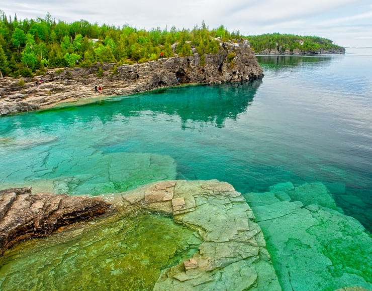
Lake Superior is the most fathomless and largest lake of the entire Great Lakes system, but it is also the largest freshwater lake globally in terms of surface area. Its area is 82.1 thousand square kilometers.
The lake’s volume is 12,000 km3, length – 563 km, width – 257 km, maximum depth – 406 m. The origin of the lake is glacial-tectonic.
In the Ojibwe language, the lake is called Gichigami, which means “Big Water.” This large lake is located between the bo der of Canada and the United States. It is part of the system of freshwater lakes of these countries, called the Great Lakes.
Its northern shore is located in the province of Ontario, and the western and southern ones are located in the states of Michigan, Wisconsin, and Minnesota.
The lake is located in a hollow at an altitude of 183 m above sea level; an ancient glacier gnawed it in the solid rocks of the Canadian Shield.
The coastline of Lake Superior is heavily indented, forming the large bays of Whitefish and Kivino. The lake feeds more than 210 rivers flowing into it. The average annual temperature is 7 degrees.
The fauna of the lake is prosperous in various marine species, and the most numerous and widespread are yellow perch and trout.
There are many islands on the lake, Madeleine, Isle Royale, Michipikoten being the largest one.
Lake Superior contains clear, cold water in its central part; even in summer, it does not warm up above 4 degrees.
In winter, powerful storms prevent it from freezing. Only the coastal zone is covered with ice from December to April.
2. Victoria

| Name | Lake Victoria |
| Dimension | 69,484 sq. km |
| Locality | East Africa |
| Specialty | Africa’s largest lake |
| Mode and Time of Origin | Formed due to crustal block |
| Benefits | Fishing |
The fantastic Lake Victoria is the largest on the African continent. It is located at an altitude of 1134 m in the tectonic trench of the East African Platform.
Its area is 69.5 thousand square kilometers. It is 320 km long and 274 km wide. The most remarkable depth reaches 80 m with an average value of 40 m.
It covers large territories of the countries – Tanzania, Uganda, and Kenya. It is the second-largest globally, with a freshwater volume of 2,424 cubic kilometers.
Owen Falls Dam construction in 1954 turned the lake into a reservoir. The full-flowing Kagera River and many more rivers and streams flow, and the Victoria Nile flows out.
But about 80% of the water supply comes from rainfall. The lake was named after Queen Victoria by the English traveler John Speke, who discovered it in 1858.
The tropical lake has a complex relief line with many reefs, archipelagos, bays, and islands on the surface. The largest African freshwater reservoir has about a hundred species of fish.
International fishing competitions are held here. For numerous coastal residents, fishing is the primary source of income.
The treacherous lake can be extremely dangerous for fishing schooners due to sudden hurricanes and devastating tornadoes.
The equatorial-tropical climate has endowed the coastal areas with rich vegetation: succulent reeds, evergreen cypresses, banana groves, papyrus, cotton fields, acacias, and numerous coffee plantations.
Intensive deforestation of coastal equatorial forests for new agricultural land adversely affects the environmental situation, leading to the drying up of the lake.
The shores indented by bays are the habitat of a large population of hippos and crocodiles.
Rubondo Island is famous for its unique protected park and swampy territory, chosen by thousands of bird species, including colorful, gentle flamingos, beautiful antelopes, funny monkeys, proud giraffes.
3. Huron
| Name | Lake Huron |
| Dimension | 59,600 sq. km |
| Locality | Between USA and Canada |
| Specialty | Longest Coastline |
| Mode of Origin | Glacial |
| Benefits | Trade Route |
It is the second-largest lake in the Great Lakes system and is divided between the United States and Canada. It is located in the east of Lake Michigan and connects to it through the Mackinac Straits.
Hydrographically, Huron and Michigan form a single system. However, geographers still consider them t be separate bodies of water.
If they are considered a single lake, it will become the largest freshwater lake on the planet and the second after the Caspian Sea.
Its area is 59,600 square kilometers, and the volume of fresh water is 3,543 cubic kilometers. Moreover, its coastline is the longest of all the Great Lakes.
Lake Huron is 332 kilometers long and 295 kilometers wide. The maximum abyss of the reservoir goes 229 meters. Thus, Lake Huron is also the 2nd in surface area and the third in the five Great Lakes volume.
There are many islands on Huron, among which are the largest lake islands in the world – Manitoulin. The largest bays are Saginaw and Georgian bay. The most important ports are Sarnia (Canada), Bay City, Saginaw, and Appian (USA).
The lake was named after the Huron Indians by the French Le Caron in 1615. During colonization, French adventurers established a natural exchange with the Indians: alcohol, iron tools, and fabrics were exchanged for furs, the main wealth of North American forests.
Lake Huron still holds an incredible experience for those who visit it. It was used as a path for schooners and small crafts in the 17th century. It is home to numerous shipwrecks in its waters.
The most famous of them can be visited by boat, where travelers can make dives to observe its virtually intact structure!
Since 1960, there have been attempts to restore the fish population in Huron by bringing in lake trout and non-native salmon here, but only trout have been able to breed a little.
The modern area around Huron is full of industrial enterprises, whose wastewater has worsened the environment.
Some reservoir areas have an increased concentration of toxic substances and harmful heavy metals.
4. Lake Michigan

| Name | Lake Michigan |
| Dimension | 58,030 sq. km |
| Locality | USA |
| Specialty | Entirely inside the USA |
| Mode of Origin | Scar from the movement of two tectonic plates |
| Benefits | Tourist Destination |
Another lake from the North American Great Lakes – Michigan, is the only one entirely located on the territory of the United States. In this regard, it has become the largest for this country.
It is located south of Lake Superior, from Huron to the Strait of Mackinac, and the Chicago-Lockport Canal connected it to the Mississippi system.
The Michigan shores are divided between Indiana, Michigan, Wisconsin, and Illinois. The first European to see this lake in 1634 was the Frenchman J. Nicollet.
Michigan is approximately 517 km long and 190 km wide. Its water surface is 177 m above sea level, and its maximum depth is 281 m containing 4918 km3 of freshwater.
Ice stays on the lake for up to 4 months. The lake is covered with ice for the four coldest months of the year.
The lake is also home to natural parks on its shores, such as the Sleeping Bear Dunes National Lakeshore, the Indiana Dunes National Lakeshore, and the Hiawatha National Forest and Manistee National Forest reserves.
5. Tanganyika

| Name | Lake Tanganyika |
| Dimension | 32,900 sq. km |
| Locality | Central Africa |
| Specialty | Longest Freshwater Lake |
| Mode of Origin | African Plate rifting |
| Benefits | Rich in minerals |
This large lake in Central Africa is also the longest freshwater lake globally. It is profound and ancient, which has similarities with Lake Baikal; therefore, it is second only to the Siberian reservoir in terms of depth and volume.
Africa’s second-largest lake is shared by Burundi, the Democratic Republic of Congo, Tanzania, and Zambia, on the western side of the Rift Valley.
Tanganyika is one of the longest lakes worldwide, not counting the Caspian Sea, 673 km in length. Its average width is 50 km.
The area of the lake is 32,900 square kilometers. The lake is located 773 m above sea level in the bottomless tectonic depression in Africa.
The underwater threshold divides the lake into two deep reservoirs. The lake is part of the vast Congo River basin, opened in 1858 by the British Burton and Speke.
The maximum depth is 1,470 meters, and its banks are home to four protected areas: the Rusizi Nature Reserve in Burundi, the Gombe Stream National Park, the Mahale Mountains National Park in Tanzania, and the Nsumbu National Park in Zambia.
Ruzizi and Malagarasi flow into Tanganyika, and only Lukuga flows out of it. Life in Tanganyika exists only to a chasm of 200 meters. Then, too much hydrogen sulfide, organic silt, and sedimentary minerals appear in the water.
At the same time, the layers of water in the lake do not mix. Therefore, its chemical composition and temperature are preserved at each level.
6. Baikal

| Name | Lake Baikal |
| Dimension | 31,500 sq. km |
| Locality | Siberia |
| Specialty | Cleanest Lake |
| Mode of Origin | Tectonic Shift |
| Benefits | Excellent for Drinking |
Baikal is the largest water reservoir, containing 20% of the world’s freshwater reserves, 23 600 km3 in volume.
Asia’s largest freshwater lake is in southern Siberia, between Irkutsk Oblast and Buryatia, Russia. It is also considered the oldest lake globally as it arose 20-30 million years ago in tectonic shifts.
The lake’s basin is located in a very deep aperture formed due to faults in the Earth’s crust. The lake’s average depth is 745 meters; the maximum depth is practically sea-standing at 1637 meters.
Baikal stretches for 636 kilometers while having a relatively modest width of no more than 80 km.
Baikal is also regarded as one of the cleanest lakes in the world. Some particular factors ensure the purity of Baikal water.
The endemic microscopic crustacean Baikal Epischura lives here, fishing huge masses of bacteria and algae from the water.
In addition, the basin of the lake and its catchment area consist of rocks that do not allow mineral substances and sediments to penetrate from sedimentary rocks into Baikal water. The water in this oligotrophic lake has excellent drinking qualities.
Life is in full swing even at great depths, thanks to pristine water, high oxygen levels, vertical and horizontal whirlpools, and warm geothermal waters.
The water is so transparent that stones at a depth of 40 m are visible through the meter-thick bottom in winter. The shores of the deepest lake in the world are the most picturesque wild landscape.
Dry mountain steppes gently descend to the blue water. Its large ecosystem includes up to 1,800 plant and animal species, most of which are endemic.
There are more sunny days in the Baikal region, but paradoxically, the sun is much less than in winter in summer.
It rains almost all the time in August. The area is known for strong winds, and fishers talk about sudden storms.
7. Great Bear Lake

| Name | Lake Great Bear |
| Dimension | 31,153 sq. km |
| Locality | Canada |
| Specialty | A shape resembling to letter H |
| Mode of Origin | Erosion of Ice |
| Benefits | Home to Bears |
It is the largest inland lake in Canada and ranks 4th in North America. It is located 156 m above sea level. From it flows the Great Bear River or Sahtu-De, flowing lower into the Mackenzie River.
Great Bear Lake is situated in the northwestern part of Canada. Its area is 31,153 square kilometers; the maximum depth is 446 meters.
The reservoir has an irregular shape, resembling the letter H. It is the largest freshwater lake and is located entirely within Canada.
The reservoir is bordered by boreal forest and tundra, known for its crystal clear waters. It is home to speckled trout and several other species.
But Great Bear Lake has the most miniature variety of fish of any species in Canada’s Great Lakes. The water is frozen here (until the end of July). The lake got its name in honor of the bears living nearby.
This reservoir has a not particularly positive history. In 1930, a uranium deposit was found near the lake, making the area suitable for the mine site.
On this site, the uranium was mined, with which the USA created the first atomic bombs. The USA dropped the bombs on Hiroshima and Nagasaki. Later, due to unprofitability, this mine was closed.
There are only two settlements on the lake: Deline in the southwest and Port Radiy or Eco Bay in the northeast.
Harsh climatic conditions leave the area around the lake sparsely populated with poor infrastructure. But at the same time, the tourist sphere of activity is widely developed here.
Campgrounds and hotels have been built along the shores. Tourist groups come to admire the nearby waterfalls and the northern lights.
8. Nyasa

| Name | Lake Nyasa |
| Dimension | 30,044 sq. km |
| Locality | Africa |
| Specialty | Surface water is warmer than deep water |
| Mode of Origin | Volcanic Activity |
| Benefits | Home to 400 species of freshwater fish |
Lake Nyasa lies in the Rift Valley, between Malawi, Tanzania, and Mozambique, and is 560 km long, 80 km wide, and has a maximum depth of 706 meters and an area of 30,044 sq. Km.
Nyasa is listed as the 9th largest lake globally and the third in Africa. Nyasa contains 7% of the world’s reserves of fresh water.
Since it is located in an area with a tropical climate, the lake has curious features with its surface warmer than its deepest layer as it undergoes stratification.
This lake was discovered in 1616 by the Portuguese Gaspar Bucarru; however, people soon forget it. As a result, in 1859, the Scotsman Livingston re-discovered the same reservoir.
The uniqueness and beauty of this place amazed the Briton, who christened it The Lake of Stars; however, on the maps, it began to be designated by the local name of Nyasa.
Another name for this reservoir is Lake Malawi. Lake Nyasa is the only freshwater lake globally that has its biogeographic province. It is the habitat of more than 400 species of freshwater fish.
Although seasonal fishing is permitted in some areas of Nyasa, most of the sites are designated marine reserves to protect fish and other inhabitants from extinction.
The Ramsar Convention protects Nyasa and its southern part, in Lake Malawi National Park, is still a UNESCO World Heritage Site.
9. Great Slave Lake

| Name | Lake Great Slave |
| Dimension | 28,568 sq. km |
| Locality | Canada |
| Specialty | Deepest Lake in North America |
| Mode of Origin | Glaciation |
| Benefits | Suitable for fishing and hunting |
This lake, the second-largest in Canada and located in the Northwest Territories of the country, is of glacial-tectonic origin.
The name of the lake was given by the European Samuel Hearn, who discovered it and wanted to perpetuate the name of the Athabaskan Indian people – slavey.
They lived in the lake area, but the Anglo-Saxon ear took it in its way; as a result, the lake turned into a Slave Lake.
Its area is 28,568 square kilometers, and its length is 480 kilometers. The maximum depth of the Great Slave Lake is 61 meters, so it is considered the deepest in North America.
Various cities reside on the lake’s edge: Yellowknife, Pine Point, and Fort Resolution. Due to its situation on the south of the Arctic Circle, the pond freezes in winter and maintains temperatures so low that it can support the weight of trucks.
As a result, residents often pave an icy road along with it, shortening the path between Yellowknife and Detta.
Coniferous forests surround the western boundaries of the reservoir. The rugged coastline is covered with tundra landscapes in the north and east.
Shipping is only possible during a very short summer. The rich natural world inhabiting the water area includes shimmering trout, whitefish, American cranes.
The Indians living near the lake are engaged in gathering, fishing, hunting, and fur harvesting, as they did many centuries ago.
10. Erie

| Name | Lake Erie |
| Dimension | 25,700 sq. km |
| Locality | Between Canada and USA |
| Specialty | Freezes faster |
| Mode of Origin | Glaciation |
| Benefits | Vital for Agriculture |
Lake Erie, divided between Canada and the United States, is the fourth in the Great Lakes system. Lake Erie stretches from northeast to southwest for 388 kilometers, and its maximum width is 92 km.
The lake shores are divided between Ontario and the states of Ohio, Michigan, New York, and Pennsylvania.
The water level in Erie is at around 174 m, and its water reserves are 500 cubic Km. There are many islands in the western part of the lake.
The lake’s water temperature ranges from 24 degrees in summer to 4 degrees in winter. From December to March or April, the coastal part of the lake is covered with ice.
Over Lake Erie, there is a striking snow effect. Cold air masses circulating over the warmer water of the lakes collect moisture above them, which is discharged in the form of powerful snowfalls in the Buffalo area of New York. But if the lakes freeze, then this immediately weakens the snowfall.
Since Erie is smaller than other Great Lakes, it freezes more often and faster than the rest. It is vital for agriculture, as it changes the microclimate in the district.
On the north coast of Erie, there are excellent fruit-bearing Canadian fruit trees and vegetable production zones. Even grapes are grown on the southeast coast in N w York, Pennsylvania, and Ohio.
Conclusion
These lakes have been facing similar environmental challenges. The intensive use of water bodies in industrial activities, environmental pollution, global warming of the climate negatively affect the ecosystem, water transparency, and the populations of aquatic inhabitants.
To preserve environmental safety and restore the disturbed natural balance, the internal policy of states should be aimed at protecting the environment of our beautiful planet Earth.
(Last Updated on April 28, 2022 by Sadrish Dabadi)